
LixelKity K1 — Compact Yet Powerful
At under 1kg, the LixelKity K1 packs 360° LiDAR, dual 48-megapixel panoramic vision, inertial navigation and onboard RTK into a wearable form factor — built for rapid, tripod-free capture in confined and hard-to-reach spaces.
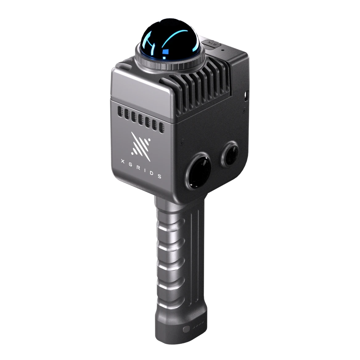
LixelKity K1
Wearable SLAM LiDAR Scanner · XGRIDS
<1 kg · IP54 · -20°C to 50°CRapid Capture, Zero Setup
The LixelKity K1 integrates vision, LiDAR, inertial navigation and high-performance computing into a device weighing under 1kg. Dual 48-megapixel panoramic cameras and 360° LiDAR combine to deliver relative accuracy of 1.2cm and absolute accuracy of 3cm — without a single tripod setup.
Colourised .las point clouds write directly to a replaceable 256GB TF card, with fast USB 3.1 Gen2 offload to a workstation. A full battery charge takes about 2 hours, and the IP54-rated body operates reliably from -20°C to +50°C, in the field or indoors.
Full-surround capture in a single pass
Precise absolute positioning on the move
Swap cards in the field for uninterrupted capture
Dust-protected, splash-resistant field durability
Key Benefits
Sub-1kg wearable design reaches tight, hard-to-access areas standard scanners can't.
No static setups — walk-and-capture covers ground quickly.
IP54 protection and a wide operating range for real-world job sites.
Sentra provides demos, training and after-sales support as official reseller.
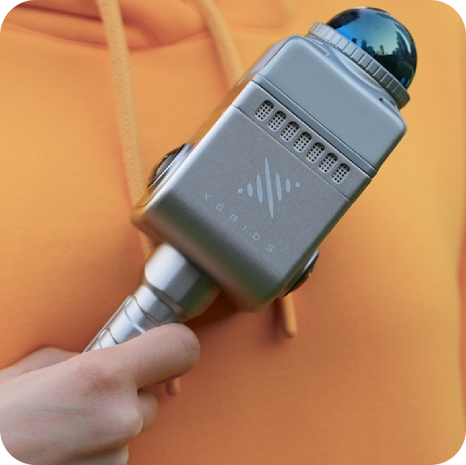
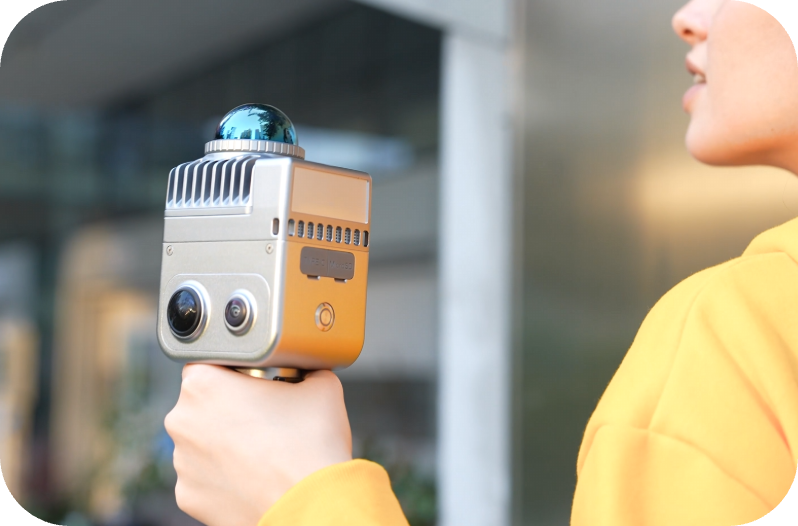
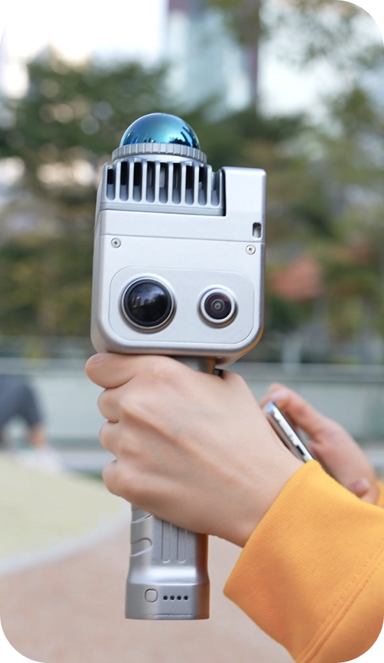
Why K1 Outperforms Traditional Methods
Tripod-based scanning requires days on-site, expensive specialists, and weeks of post-processing. Projects stall waiting for deliverables. The K1 changes everything.
Real-Time Colored Models
Eliminate post-processing delays — see colored point clouds as you scan.
<1kg Handheld Operation
No tripods or specialists required — one operator, one device.
±1.2cm Accuracy
Survey-grade precision at 1/3 the equipment cost of traditional methods.
Review On-Site
Review results in the field — eliminate return visits and rework.
Specs That Deliver on the Promise
Multi-SLAM algorithms ensure reliable capture in challenging environments. 48MP panoramic cameras capture rich color data while 360° LiDAR provides comprehensive spatial coverage at 200,000 pt/s. IP54 rating handles real-world conditions.
Accuracy
Points / Sec
Range
Battery
Panoramic Cameras
Weight
Three Steps to Professional Results
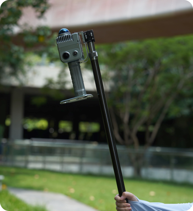
Scan
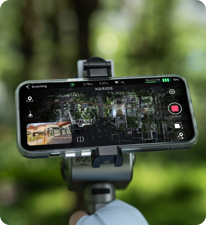
Walk and capture with one-button operation. Use LixelGo — the companion mobile app for real-time scanner control, mission planning, and field monitoring.
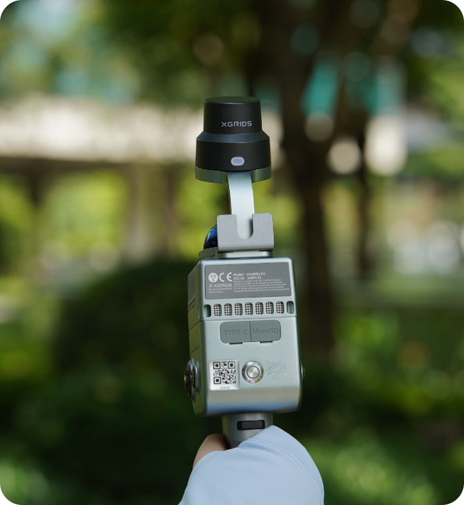
Process
Automatic real-time point cloud generation, or additional processing with LixelStudio or LixelCyberColor for higher quality output.
Deliver
Export to CAD/BIM or publish interactive 3D models — ready for clients, collaborators and stakeholders.
The LixelKity K1, In the Field
Trusted by Industry Professionals
What Makes the LixelKity K1 Different
Sub-1kg Wearable Design
Lightest device in the XGRIDS range — wear it and capture hands-free in confined spaces.
360° LiDAR Coverage
Full-surround LiDAR combined with dual 48MP panoramic vision for complete scene capture.
Onboard RTK
Real-time kinematic positioning for 3cm absolute accuracy without ground control points.
Replaceable Storage
256GB TF card writes colourised .las point clouds directly, with USB 3.1 Gen2 offload.
Fast Charging
Full charge in around 2 hours, ready for back-to-back field sessions.
IP54 Rugged Rating
Dust-protected and splash-resistant, operating from -20°C to +50°C.
Where the LixelKity K1 Excels
Confined-Space Scanning
Wearable form factor accesses tight interiors, basements and utility rooms tripod scanners can't.
Rapid Facility Documentation
Fast walk-through capture for facility management, retrofit and clash detection.
Public Safety & Forensics
Quick, repeatable scene documentation for accident reconstruction and site investigation.
Heritage & Interior Documentation
Non-invasive, detailed capture of interiors and heritage sites in a single lightweight pass.
LixelKity K1 Specifications
| Weight | < 1 kg |
|---|---|
| Enclosure | IP54 (dust-protected, splash-resistant), -20°C to +50°C operating range |
| Sensors | Vision, LiDAR, inertial navigation and high-performance compute integrated |
| Point Rate | 200,000 pts/sec |
| Scan Range | 0.1–40 m |
| Accuracy | Relative 1.2cm · Absolute 3cm |
| Vision | 48-megapixel × 2 panoramic vision + 360° LiDAR |
| Positioning | RTK enabled |
| Storage | Replaceable 256GB TF card · USB 3.1 Gen2 offload |
| Battery | Full charge in ~2 hours |
| Output Format | Colourised .las point clouds |
Need the full technical datasheet?
Download the complete LixelKity K1 brochure
Complete Solution, Maximum Flexibility
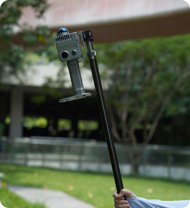
Extension Pole
Reach elevated vantage points for overhead captures in large interiors and infrastructure.
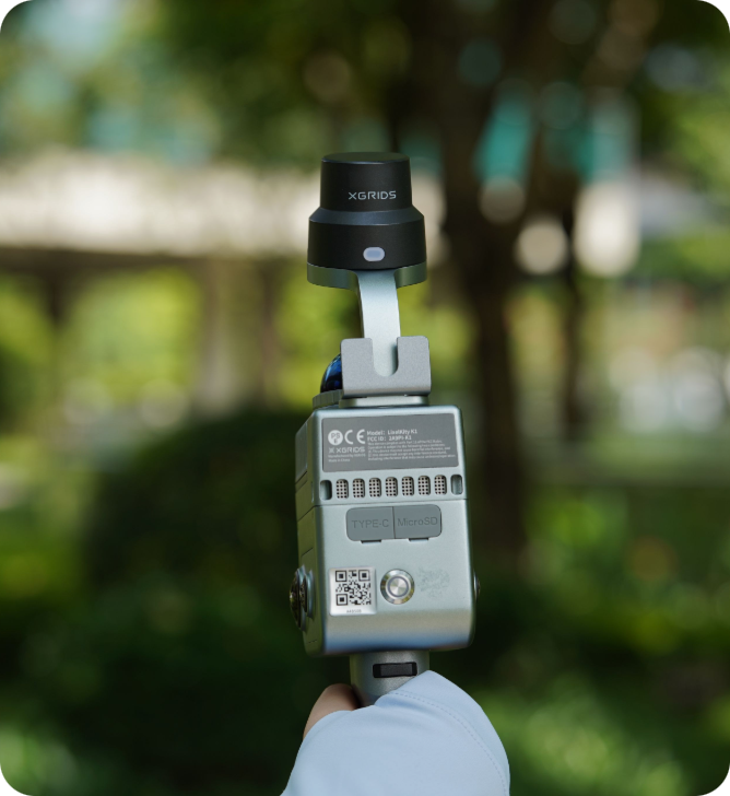
RTK Module
Built-in RTK for centimetre-level absolute positioning — no ground control points needed.
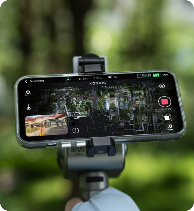
Phone Mount
Securely attach your smartphone for live LixelGo app monitoring during scan sessions.
Built for Every Industry
Architecture & Construction
Interior documentation, as-built surveys, progress monitoring, BIM integration
Infrastructure & Resources
Volume calculation, mining surveys, facility documentation
Real Estate & Property
Property assessment, renovation planning, digital twin
Cultural Heritage
Artifact preservation, museum digitization, historical documentation
Environmental Conservation
Ecosystem monitoring, climate impact studies, habitat preservation
Got Questions About the LixelKity K1?
Can't find what you're looking for? Contact our team — we're happy to help.
No — the K1 is designed as a wearable, handheld device. Simply walk through the space to capture full 360° LiDAR and panoramic vision data.
The K1 is lighter (under 1kg vs 1.2kg) and optimised for confined, short-range capture (0.1–40m). The Lixel K2 offers a longer range (up to 100m) and a triple-camera array better suited to general-purpose outdoor survey work.
A replaceable 256GB TF card writes colourised .las point clouds directly during capture, with USB 3.1 Gen2 for fast data offload.
Yes — the IP54-rated enclosure is dust-protected and splash-resistant, and the device operates reliably from -20°C to +50°C.