
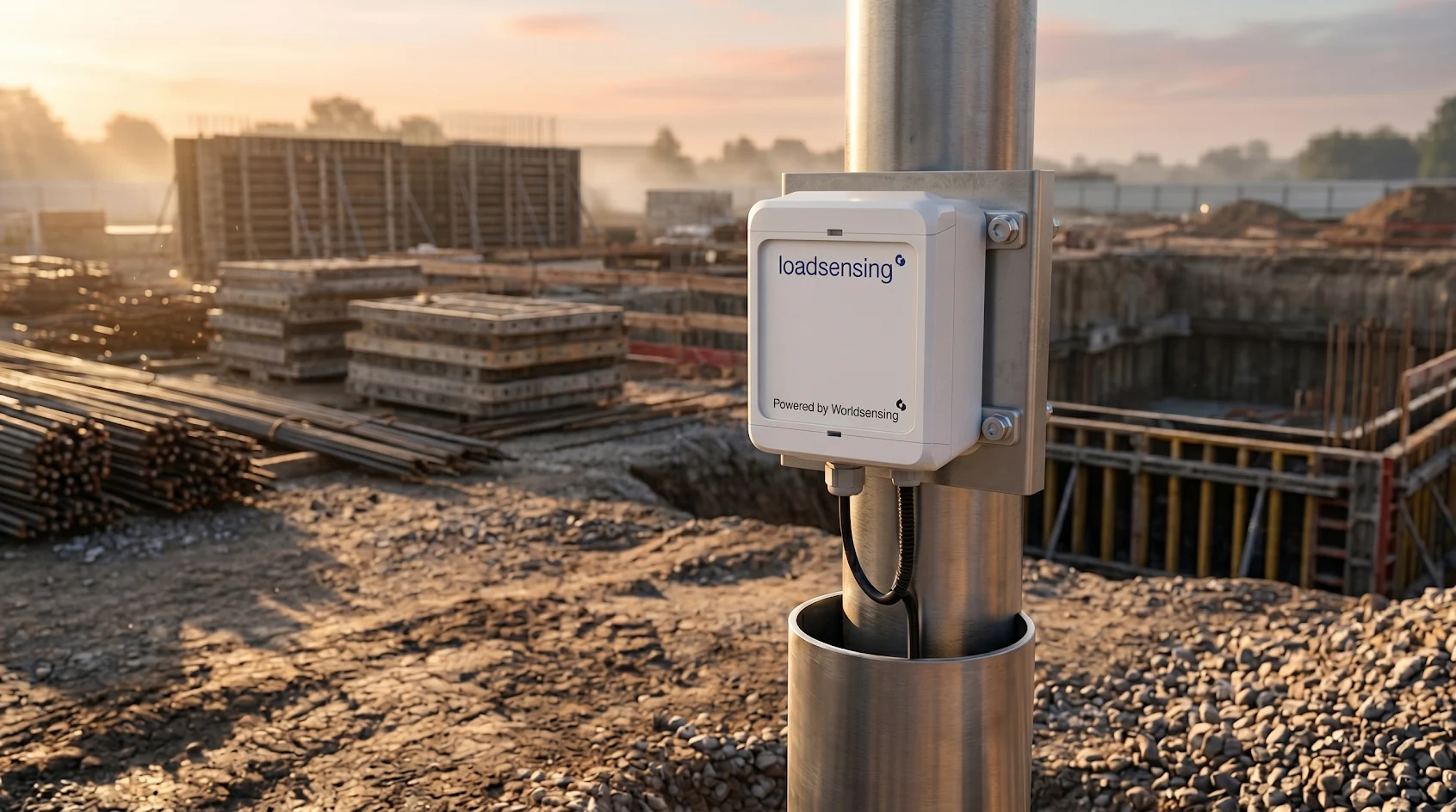
Geotechnical & Foundation Monitoring
Ground-level intelligence that keeps projects safe and on schedule — real-time settlement, slope stability, and piezometric data from sub-millimetre precision instruments.
Real-Time Ground Intelligence for Construction & Infrastructure
From deep excavation monitoring to long-term slope stability surveillance, Sentra's geotechnical monitoring programmes provide the ground truth that engineers and project managers need to make safe, informed decisions.
From Borehole to Dashboard — Complete Geotechnical Monitoring
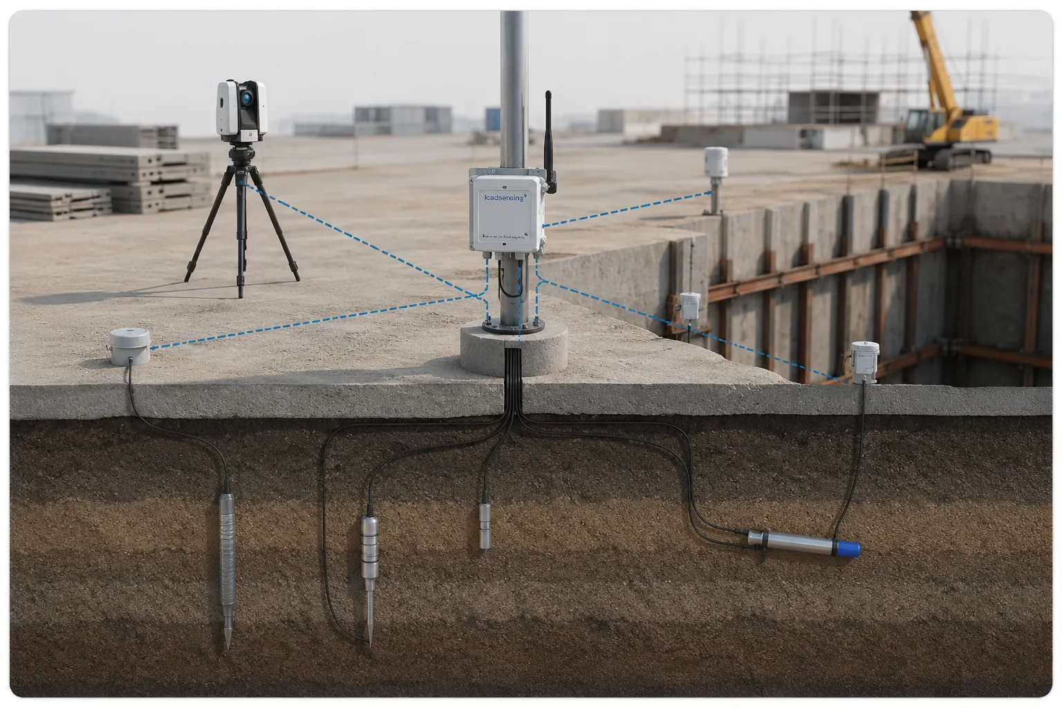
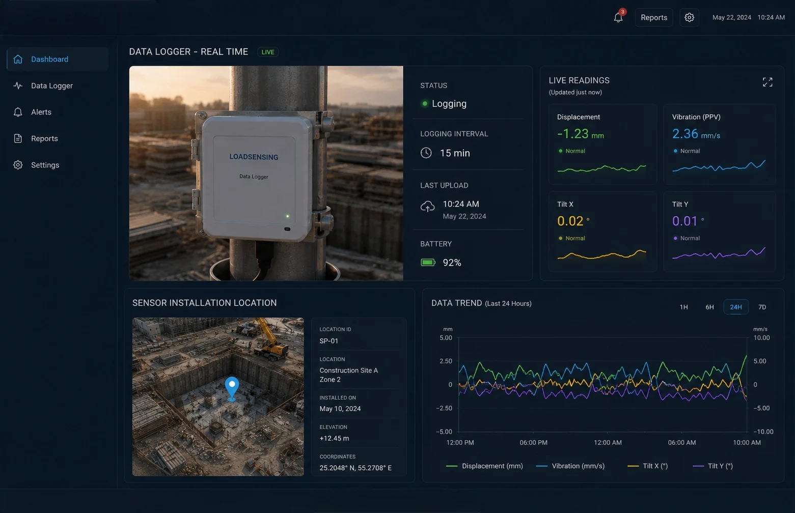
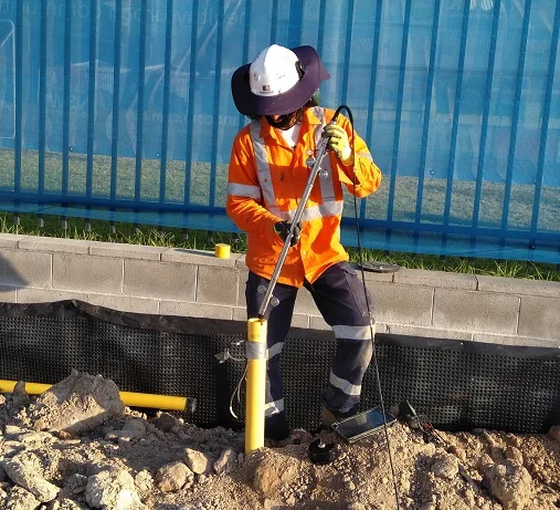
Ground behaviour is complex, three-dimensional, and often invisible — yet it governs the safety of every major construction project, tunnel, embankment, and slope. Sentra's geotechnical monitoring service deploys the full range of subsurface instruments — settlement plates, inclinometers, piezometers, vibrating wire strain gauges, tiltmeters, and seismographs — connected via our IoT data acquisition network to a real-time cloud dashboard. Our geotechnical engineers design monitoring programmes that are aligned with the specific ground conditions, construction activities, and risk profile of each project. We install instruments into boreholes, embankments, retaining walls, and foundation elements, and configure alert thresholds based on ground movement trigger levels defined in the geotechnical design. From construction-phase excavation monitoring to permanent long-term slope surveillance, we provide continuous ground intelligence that protects workers, prevents property damage, and keeps projects on programme. When ground behaviour exceeds alert thresholds, our engineers are available around the clock to interpret data and advise on appropriate response.
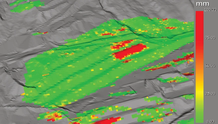
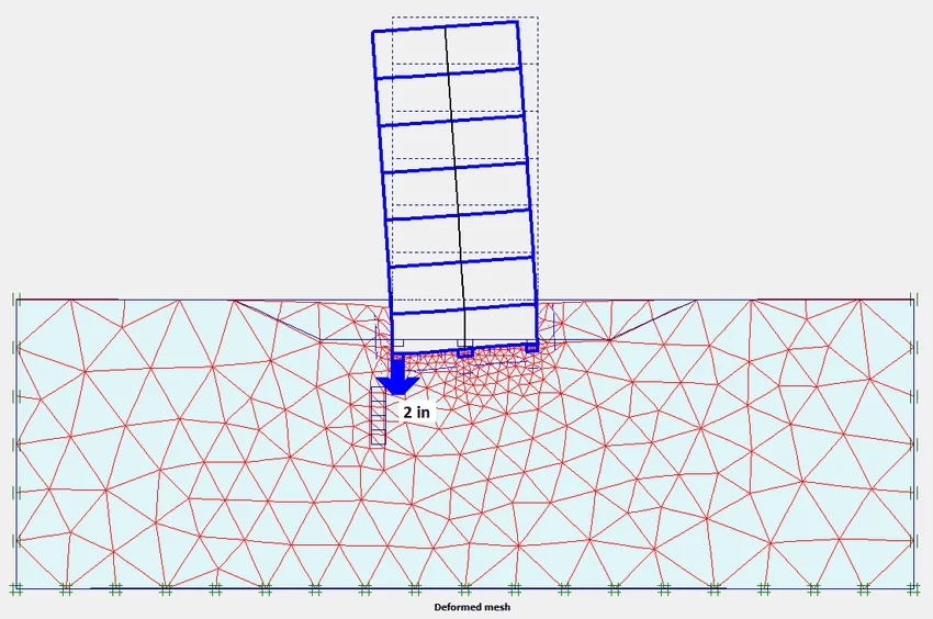
Settlement sensors, GNSS stations, and precise levelling arrays measure vertical ground movement and differential settlement at foundations, adjacent structures, and surface infrastructure with sub-millimetre resolution.
In-place inclinometers, surface tiltmeters, and GNSS arrays track lateral deformation within slopes and embankments, enabling early detection of failure plane initiation before surface cracks appear.
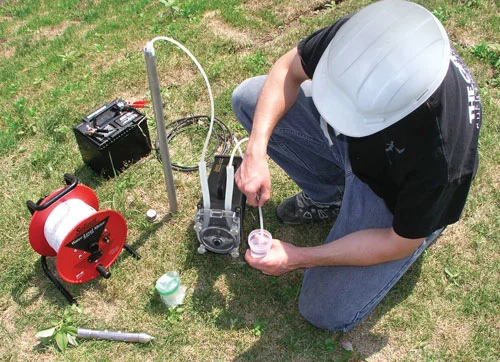
Vibrating wire piezometers measure pore water pressure changes in response to construction activities, rainfall events, and tidal fluctuations — the critical driver of slope instability and embankment failure.
Inclinometers and tiltmeters monitor lateral deflection of sheet piles, diaphragm walls, bored pile walls, and retaining structures during and after deep excavation works.
Vibrating wire strain gauges, tell-tales, and load cells installed in bored and driven piles monitor load distribution, settlement, and negative skin friction during and after construction.
Seismographs and vibration monitors record blast vibrations, traffic-induced ground motion, and natural seismic activity — providing evidence for neighbour impact assessments and blast control programmes.
Measurable Outcomes
Quantifiable results delivered through our monitoring and engineering solutions across infrastructure projects.
Track Record
Proven deliveryEfficiency
Optimised operationsReliability
Always onHow It Works
A geotechnical monitoring programme designed around your ground conditions, construction programme, and risk register.

See Our Solutions in Action
Real deployments, real impact — from field instrumentation to command centre dashboards.

How It Helps Your Organisation
Real-time ground data protects workers, accelerates projects, and provides the engineering evidence base for critical decisions during construction and throughout asset life.
What It Prevents
Unmonitored ground is the source of the most serious and costly construction failures. Geotechnical monitoring eliminates these risks by providing real-time visibility of ground behaviour.
Industries We Serve
Wherever construction, mining, or infrastructure development interacts with ground, Sentra's geotechnical monitoring provides the safety intelligence that projects require.
Why Choose Sentra
Ground Monitoring Success Stories
Real-world geotechnical monitoring deployments ensuring safe construction and long-term ground stability.
Related Solutions
Complementary services that support geotechnical and foundation monitoring programmes.
Frequently Asked Questions
Can't find what you're looking for? Contact our team — we're happy to help.
Geotechnical monitoring is the systematic measurement of ground behaviour — settlement, lateral movement, pore water pressure, and vibration — using instruments installed in or on the ground or in structures. It is required during construction activities that interact with the ground (deep excavations, tunnelling, piling, embankment construction), during long-term operation of infrastructure on or in unstable ground (slopes, dams, mine tailings), and wherever ground movement could affect public safety or adjacent structures. Regulatory authorities frequently mandate geotechnical monitoring as a condition of planning consent for major construction projects.
Common geotechnical instruments include: inclinometers (installed in boreholes to measure lateral ground deformation), piezometers (measuring pore water pressure in soil and rock), settlement sensors and extensometers (measuring vertical ground movement), vibrating wire strain gauges (installed in structural elements like piles and retaining walls), GNSS receivers (surface movement monitoring), tiltmeters (measuring angular rotation of structures), and seismographs (recording vibration from blasting or traffic). The selection depends on the ground conditions, failure modes of concern, and monitoring objectives.
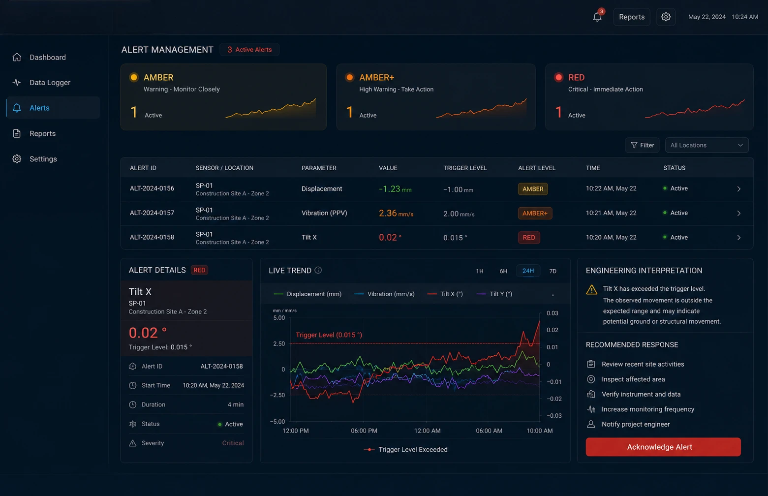
Alert trigger levels are typically defined by the geotechnical designer based on the structural capacity of affected elements, predicted ground movements, and acceptable risk thresholds. A standard three-tier system is used: Alert level 1 (Amber) — monitoring readings approach the predicted values, review required; Alert level 2 (Amber+) — readings approach the design limit state, action required; Alert level 3 (Red) — readings at or exceeding design limits, immediate action required. We configure these thresholds in the monitoring platform and ensure all project stakeholders understand the response protocols for each level.
Yes, and for many asset types long-term post-construction monitoring is essential. Railway embankments, highway slopes, dam embankments, and major retaining structures all benefit from or require permanent monitoring. We design monitoring programmes that transition from intensive construction-phase monitoring to lower-frequency long-term surveillance as the ground stabilises, reducing costs while maintaining the safety intelligence that asset owners need over the full asset life.
When a monitoring alert is triggered, the system sends immediate notifications via SMS and email to all designated project stakeholders — typically the site engineer, geotechnical designer, and project manager. The notification includes the alert level, the instrument and parameter concerned, the reading value, and the trigger level exceeded. Our geotechnical engineers are available 24/7 to provide interpretation and response guidance. All alerts are logged with timestamps and response records in the monitoring system for the project record.
Yes. We provide regular monitoring reports — typically weekly during active construction and monthly for long-term surveillance — that document all readings, trend analysis, trigger level status, and any exceedances with engineering commentary. These reports are structured for submission to regulatory authorities, building control bodies, and planning departments. We also provide final monitoring reports at the end of construction phases with a complete dataset and interpretation for the permanent project record.